Housesteads Fort, Hadrian's Wall
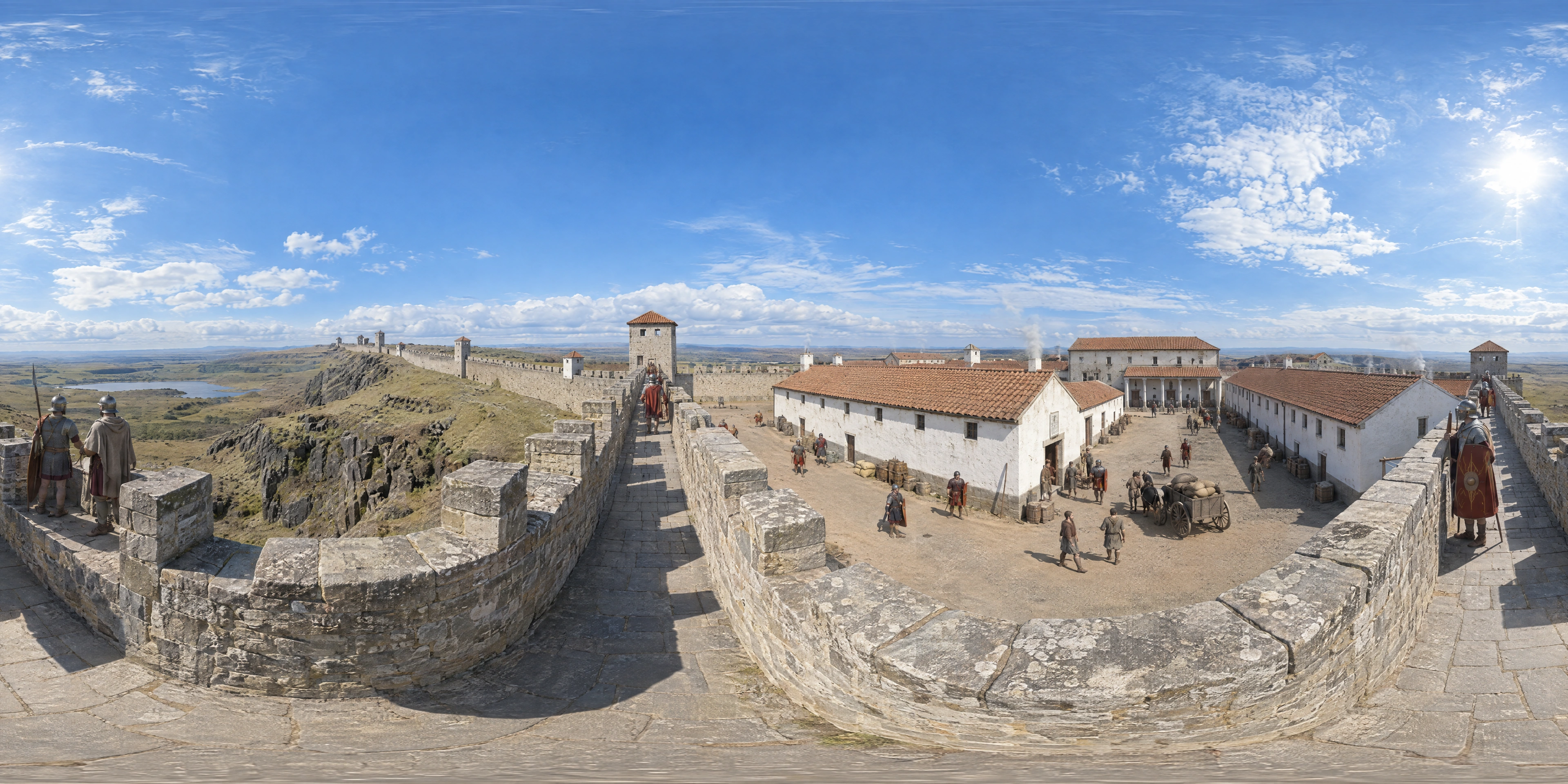
Around AD 130 the new stone fort of Vercovicium, today's Housesteads, stands on the crags of the Whin Sill with its north rampart built into Hadrian's Wall. A double-strength cohort of some 800 auxiliary infantry guards the frontier the emperor began in 122 to run 73 miles from the Tyne to the Solway.
- Year
- 130s
- Where
- Northumberland · GB
- Era
- Classical antiquity
- Coordinates
- 55.014, -2.332
The moment
The fort was an afterthought
Hadrian's Wall was begun in AD 122, probably planned before the emperor's own visit to Britain that year. The first design had no forts on the line: only milecastles every Roman mile and turrets between them, along a stone curtain running 73 miles from the Tyne to the Solway.
Then the plan changed. At Housesteads the builders pulled down one of their own new turrets, Turret 36B, and around AD 124 raised a stone fort in its place, its north wall set on the foundation already laid for the Wall.
By about 130 the fort stood at the end of a mile-long crag of the Whin Sill. The Wall had been slimmed as the work went on, from ten Roman feet thick to eight in places.
A playing card on a cliff
The fort covered 2.2 hectares in the classic Roman shape of a playing card, with a gateway in each side. Inside stood stone barrack blocks, the headquarters building, the commanding officer's courtyard house, granaries and a hospital.
In the second century the garrison was a double-strength cohort of auxiliary infantry, some 800 men whose unit name is lost, with legionaries from the Second Legion Augusta. The better-known First Cohort of Tungrians arrived only in the early third century.
Housesteads had no running water. Its people collected rain in stone-lined cisterns, and its latrine is one of the best preserved in Roman Britain.
North of the rampart the cliffs fell away to moorland and loughs. To the south lay the Vallum, a broad ditch between earth banks, and two miles south-west the older fort of Vindolanda on the Stanegate road. The Wall may have been plastered and whitewashed, but whether it gleamed here in 130 is unknown.
The name comes from a farmhouse
The Romans called the place Vercovicium; an inscription with the letters VER is read as short for it. The modern name belongs to the eighteenth-century farmhouse of Housesteads, and the ruins of the farm still lean against the fort's south gate.
In 1838 the antiquarian John Clayton bought the farm, cleared later buildings off the Roman remains and rebuilt stretches of the Wall nearby. In 1929 a later Clayton tried to auction the fort; it failed to reach its reserve and went to the National Trust in 1930.
The fort was occupied for almost 300 years. By 409 the Romans had gone.
Why Britons still walk it
Hadrian's Wall is named in England's primary history curriculum as the emblem of Roman Britain, and it has been a UNESCO World Heritage Site since 1987. It is also misunderstood. The Wall lies entirely in England and has never been the border with Scotland; its turf-built successor, the Antonine Wall of 142, crossed what is now central Scotland.
How much this landscape means became clear in September 2023, when the lone sycamore at Sycamore Gap, west of Housesteads, was felled overnight. The tree came down across the Wall itself, and in 2025 the two men responsible were jailed for more than four years.
Sources
Further reading
Tagged
- united-kingdom
- england
- northumberland
- roman-britain
- hadrians-wall
- frontier
- antiquity
- everyday-life
Published
See also

193
Legionary Fortress of Carnuntum
On 9 April 193, twelve days after the murder of Emperor Pertinax in Rome, the Pannonian legions proclaim their governor Lucius Septimius Severus emperor at Carnuntum, capital of Upper Pannonia on the Danube frontier. He wins the civil war that follows, founds the Severan dynasty and raises Carnuntum to the rank of a colony.

79
Pompeii
On a late October afternoon in 79 AD, Mount Vesuvius unleashes a Plinian eruption that buries Pompeii under meters of pumice and ash within hours.

400s
Aksum
Around 400 AD, masons of King Ezana of Aksum raise a 24-meter granite stele carved to resemble a multi-story house: a monumental tradition unique to the Aksumite kingdom of Ethiopia.