Plain of Mohács
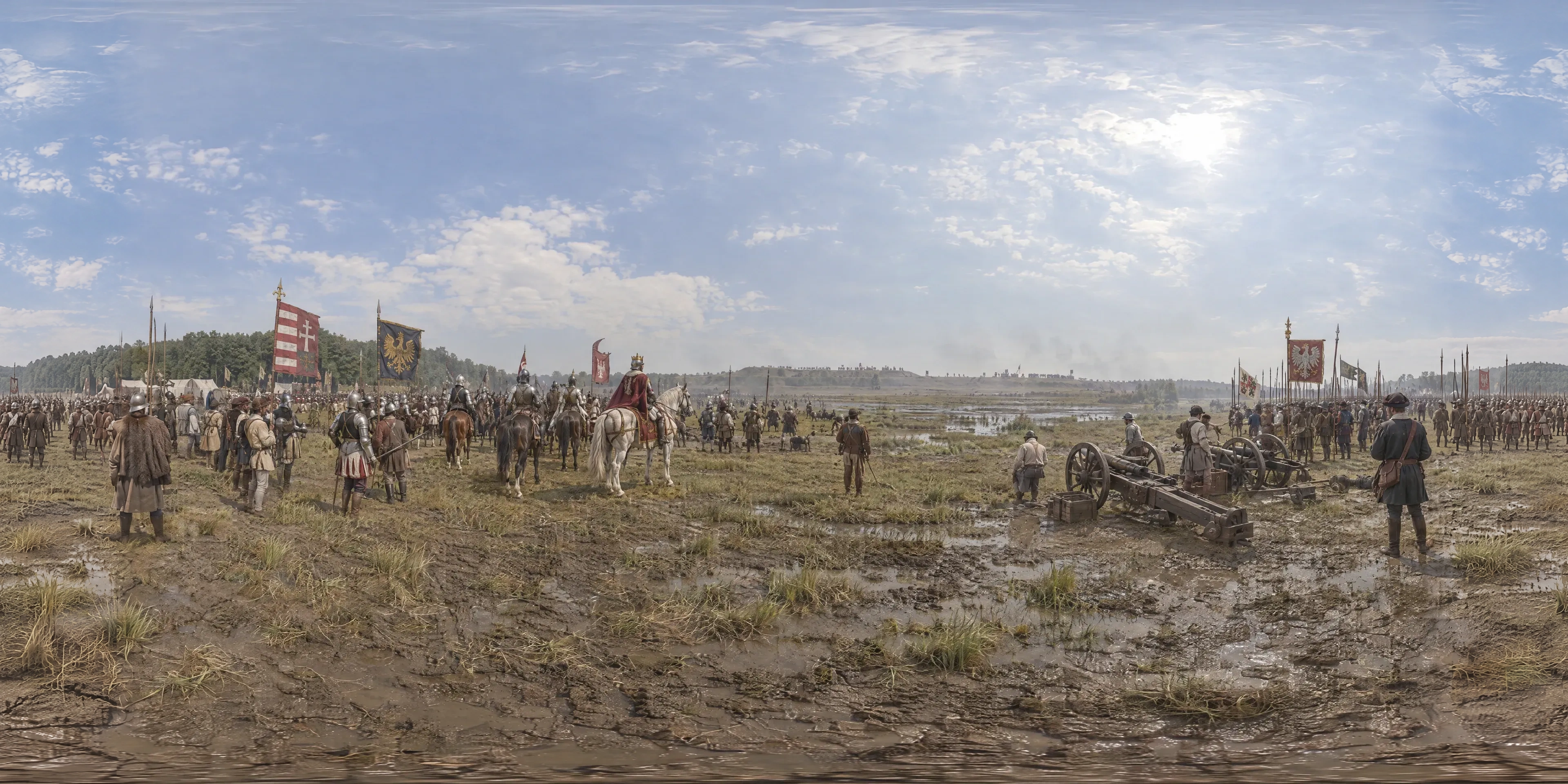
On 29 August 1526 the royal army of Hungary, some 25,000 men under the twenty-year-old King Louis II, waits for hours in the heat on the plain south of Mohács as Suleiman the Magnificent's far larger army appears on the ridge ahead. By nightfall the king has drowned in flight and the medieval Kingdom of Hungary has collapsed.
- Year
- 1526
- Where
- Southern Transdanubia (Baranya) · HU
- Era
- Renaissance
- Coordinates
- 45.943, 18.647
The moment
Hours of waiting in the August heat
On 29 August 1526 the royal army of Hungary stood for hours on a wide, waterlogged plain south of Mohács, near the Danube, waiting in the heat. At its centre rode King Louis II, twenty years old. Among its commanders was Archbishop Pál Tomori.
It numbered some 25,000 men, drawn up in two long lines: heavy cavalry from the lords' own contingents, German Landsknechts with pikes, Polish and Hungarian infantry, light hussars and about fifty guns. A bodyguard of about a thousand armoured horsemen surrounded the king.
Ahead, beyond the Borza stream, the ground rose 20 to 30 metres to the edge of a terrace some two kilometres away. In the afternoon Suleiman the Magnificent's army began to appear along its crest. Modern estimates of its size run from 50,000 to 100,000 men.
The king drowned in the Csele stream
By nightfall the royal army had been destroyed. Some 14,000 Hungarian soldiers died, among them more than a thousand nobles, seven bishops and twenty-eight barons. Two days later about 2,000 prisoners were executed.
Louis II fled. In the evening a torrential downpour flooded the streams, and in the marshy ground by the Csele the king drowned, weighed down by his armour. His body was found weeks later, buried in the mud.
Most of what is known about the day comes from an eyewitness, István Brodarics, read alongside the diaries kept on the Ottoman side.
Nobody agrees where it was fought
The exact battlefield is still disputed. Over the last hundred years sixteen theories have been put forward, placing the battle east or west of Mohács and even in what is now Croatia.
The national memorial stands near Sátorhely. Its memorial park, known for its carved wooden grave markers, opened in 1976 on the 450th anniversary; a visitor centre followed in 2011, and in 2012 the site was declared a national memorial.
Since 2018 a University of Pécs team led by the geographer and historian Norbert Pap has set the written sources against geophysics and reconstructions of the old landscape and its streams. It places the battlefield east of Majs and has traced the lost village of Földvár near Borza-Major. The argument is not over.
More was lost at Mohács
Mohács ended the medieval Kingdom of Hungary. The nobles elected two rival kings, John Zápolya and Ferdinand of Habsburg, and after the Ottomans took Buda in 1541 the country was split in three for a century and a half.
The name became a byword. Több is veszett Mohácsnál, "more was lost at Mohács", Hungarians say to shrug off a lesser misfortune.
The saying works because everyone knows the scale of the original loss: a king, much of the kingdom's leadership and the medieval state itself, gone between an August afternoon and nightfall. Any later setback, by comparison, is survivable.
Sources
Further reading
Tagged
- hungary
- mohacs
- battle
- ottoman-empire
- louis-ii
- suleiman
- renaissance
- jagiellonian
Published
See also

1543
Cathedral Hill, Frombork
In late May 1543 Nicolaus Copernicus, a 70-year-old canon of the Warmian chapter, dies at Frombork; by tradition the first printed copy of his De revolutionibus, the book that sets the Earth moving around the Sun, reached him on his last day. The walled cathedral hill, beside which he lived and watched the sky for more than thirty years, looks out over the Vistula Lagoon.

1444
Florence Cathedral, Florence
In 1444, Brunelleschi's revolutionary double-shell brick dome over Santa Maria del Fiore in Florence approaches completion: the largest masonry dome in the world, raised without scaffolding.

1410
Grunwald Battlefield
On the hot morning of 15 July 1410 the armies of King Władysław Jagiełło and Grand Duke Vytautas wait at the edge of the woods facing the Teutonic Order across the fields of Grunwald, until two heralds ride over with two naked swords from Grand Master Ulrich von Jungingen, a taunt to come out and fight. By evening the Order's army is broken and its Grand Master dead.