The Vlieter, Afsluitdijk
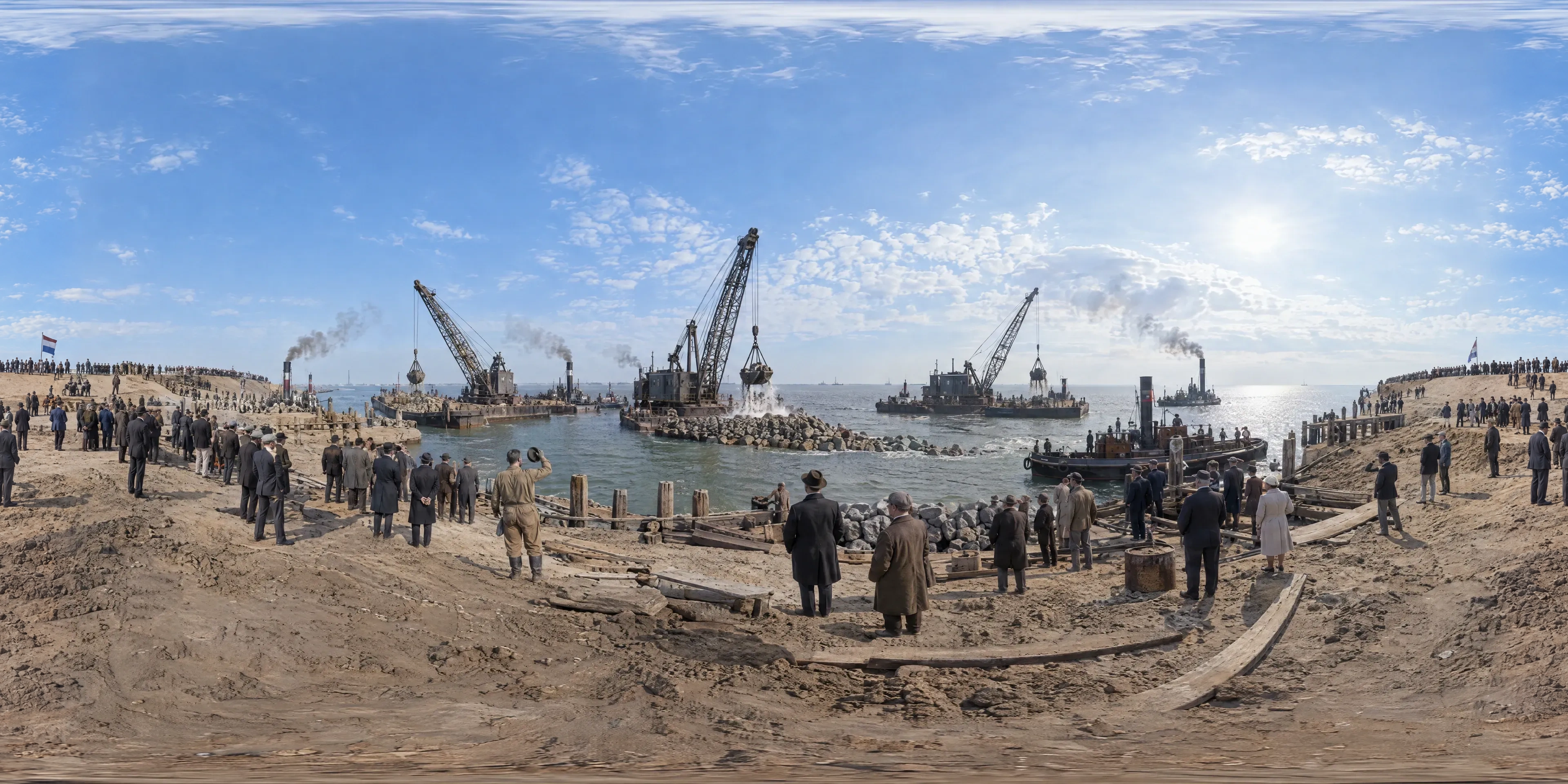
At 13:02 on Saturday 28 May 1932 three floating cranes drop the last loads of boulder clay into the Vlieter, the final gap in the Afsluitdijk, while every ship's steam whistle sounds. The Zuiderzee, for centuries an arm of the North Sea, becomes a lake, soon renamed the IJsselmeer.
- Year
- 1932
- Where
- Zuiderzee (North Holland and Friesland) · NL
- Era
- modern_early
- Coordinates
- 52.969, 5.109
The moment
The sea was shut out at two minutes past one
At 13:02 on Saturday 28 May 1932, at low tide, three floating cranes dropped their last loads of boulder clay into the Vlieter, the final gap in the Afsluitdijk. The channel between the former island of Wieringen and the Frisian coast closed, and every ship around it sounded its steam whistle.
With that the Zuiderzee, for centuries an arm of the North Sea reaching deep into the country, became a lake. It was soon renamed the IJsselmeer, and fed by rivers and cut off from the tides, it turned from salt water to fresh.
A dike built of the Ice Age
The Afsluitdijk is 32 kilometres long and 90 metres wide, and it was first built to between 6.7 and 7.4 metres above Amsterdam Ordnance Datum. Its body is sand, about 23 million cubic metres of it, and boulder clay, some 13.5 million cubic metres of the sticky grey-brown till left behind by Ice Age glaciers.
The seaward side was built of boulder clay covered with brushwood mattresses and weighed down with basalt boulders. By the end of the work, begun in 1927, some ten thousand workers were on the job, with 27 dredges, 13 floating cranes, 132 barges and 88 tugs.
A plan older than the flood that forced it
The idea was old. The engineer Cornelis Lely had worked on a plan to close the Zuiderzee since 1891, but it took the storm flood of January 1916, when dozens drowned around its shores and thousands lost their homes, to make it happen. Lely submitted his final design that September.
The physicist Hendrik Antoon Lorentz, a Nobel laureate, led the state commission that calculated how the tides and storm surges along the coast would change once the sea was closed. Lely himself did not live to see the closing: he died in 1929.
Not everyone gained. The fishing towns around the Zuiderzee lost the sea that had fed them.
Why the Dutch still call it a victory
For the Dutch the Afsluitdijk is the classic victory over the sea, the heart of the Zuiderzee Works. It turned the Zuiderzee into the IJsselmeer and opened the way to reclaiming new land, above all the polders that became the province of Flevoland.
The dike was formally opened on 25 September 1933, and a monument by the architect Willem Marinus Dudok stands at the spot where the Vlieter was closed. The road across it has carried traffic ever since.
It is still being strengthened. Renovation began in 2019 to raise the dike by about two metres, and a fish migration river is being cut through it to give fish back the passage the closure took from them.
Sources
Further reading
Tagged
- netherlands
- afsluitdijk
- zuiderzee
- ijsselmeer
- water-management
- engineering
- interwar
- 1932
Published
See also

1944
Omaha Beach, Normandy
At 6:30 a.m. on June 6, 1944, the first waves of American soldiers from the 1st and 29th Infantry Divisions wade ashore at Omaha Beach under heavy German machine-gun fire in the bloodiest landing of D-Day.

1939
Lower Wenceslas Square, Prague
On the morning of 15 March 1939, in a heavy fall of wet snow, German columns roll down Wenceslas Square as Hitler's troops occupy what remains of Czechoslovakia. Thousands of Praguers watch from the pavements, weeping, booing and singing the national anthem; that evening Hitler reaches Prague Castle, and the next day he proclaims the Protectorate of Bohemia and Moravia.

1945
Mt. Suribachi, Iwo Jima
At midday on February 23, 1945, six United States Marines raise a larger replacement American flag on a length of iron pipe atop Mt. Suribachi on Iwo Jima, captured in Joe Rosenthal's photograph.